Translate

Showing posts with label Great Miami River. Show all posts

05 April 2011

Bike-commute day 11—to work
How not to smooth auto-bike traffic

The rains stopped last evening, and the roads were dry in the morning. But as I crossed the Monument Street bridge, shielding my eyes from the bright sunshine, I saw the river was overflowing to the bikeway. Since I was on my Lotus fixed-gear, taking the gravel concourse above the river was out of the question, and I took the sidewalk—slowly, careful of two pedestrians and one with a vacuum cleaner in tow—against the flow of traffic in the street. At the ziz-zag down near the Green Bridge, I saw that the Mad River was living up to its name: an even higher and stronger flow was coursing into the Miami, and the bikeway was flooded at least to the railroad trestle near Valley Street.

So I took Monument Avenue through the light manufacturing area.

One pickup driver did everything possible to thwart his easy entrance to Monument from a service yard. As I rode along Monument going east, a pickup driver pulled to the street from a Rumpke service yard, stopped, looked both ways, apparently saw me, and released his brakes enough to coast an additional 3 feet. I interpreted his coasting as impatience and potentially a sign that he had not seen me approaching. I slowed a lot, expecting him to pull into the street. He stopped again. It was clear he had seen me, and he had just anticipated moving into the street prematurely. His impatience (my inference here) resulted in a few more seconds of stopping before his turn onto Monument, and (I infer again) increased what impatience he already felt.

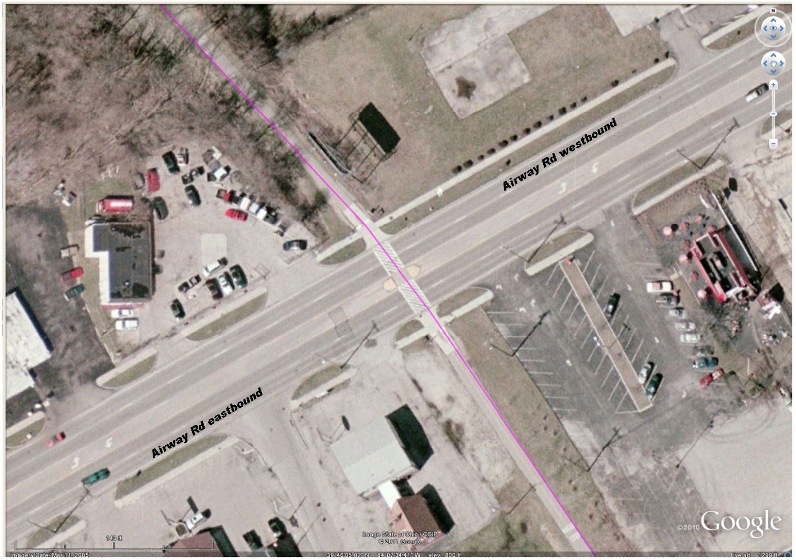
Bikeway crossing (magenta) at Airway Rd, Riverside OH
Then another pair of drivers exhibited their at-any-cost ownership of the road at the bikeway crossing at Airway. This crossing is well marked with pedestrian slashes embossed on the street, auto signs posted for the approaching two lanes of autos from each direction, in-path signage for the approaching bikeway users, and a pedestrian island placed to allow a pause in the crossing. As I approached the crossing from the north (top of image), the street was clear of traffic from the east, and two vehicles approached from as far away as Linh's Restaurant. —At about the location of the green car in the image.— I crossed the two westbound lanes, and saw neither of the two roadway users were slowing. So I stopped at the island. The near driver, of a pickup marked Extermital, sneered and flipped me off. Do I infer again some attitude of impatience—or dominance—from this driver?

No ego from me (for once) feels offence. No shift in mood. And my mood was heightened not more than a couple miles down the bikeway, at the corner of the DPL Executive Golf Course. My happy whistling startled three beautiful, strong deer who looked up from their grazing beside the bikeway. They glanced at each other, then scattered into the trees that line the bikeway. Four more deer inside the DPL compound galloped in the opposite direction toward the tree-lined creek.

At Woodbine, I saw Two-dog-Jason approaching the crossing from the south. Since I had to stop for a car, my crossing was slow. I introduced myself and Two-dog-Jason told me his name: Pat. It's been at least three years that we've seen each other on the bikeway during my morning commute. Finally there are real names for us to add to our hellos.

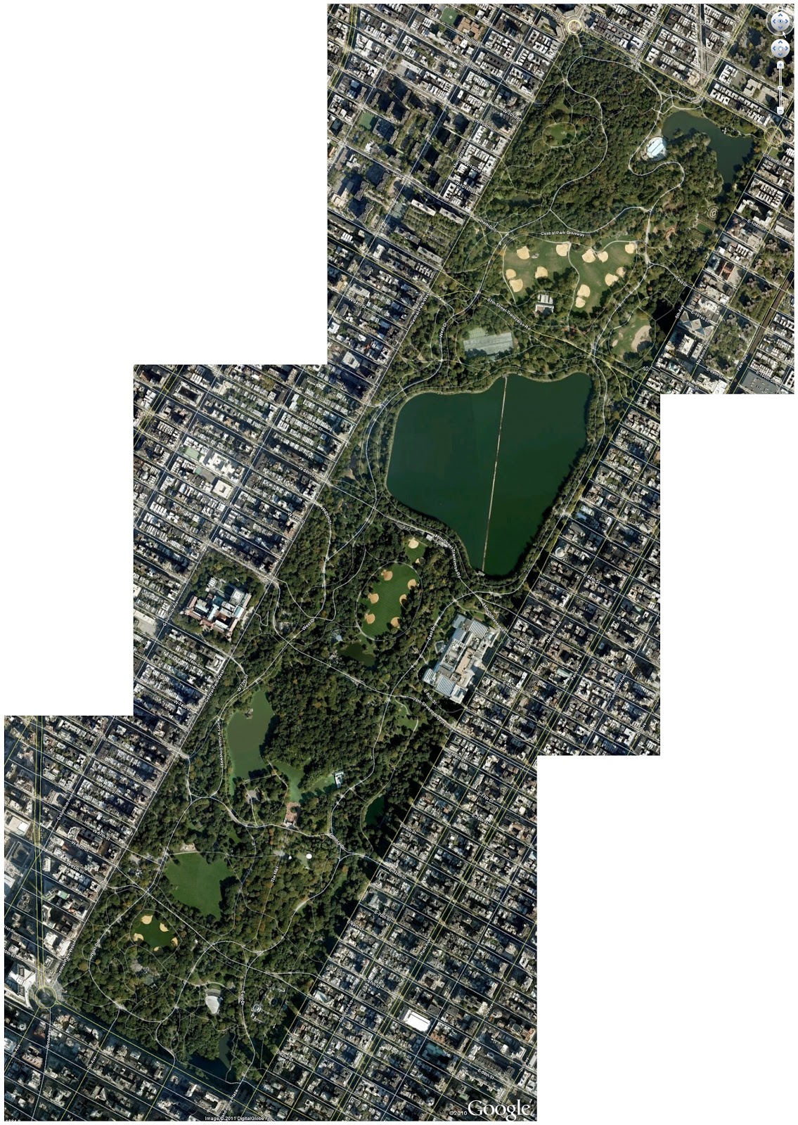
Central Park, New York City
In New York City's Central Park another controversy is developing. In the hardcopy version, the article was titled "Neither Pedestrian Nor Auto." (It is otherwise titled in the online edition.) But the summarized assertion of the original title exhibits a basic misunderstanding of the position of the bicycle in the mix of transportation. Absolutely the bicycle is a vehicle. The cyclist is also a pedestrian—when a cyclist dismounts, the transformation is then complete. But nevertheless, all—motorist, cyclist, and pedestrian—must obey posted traffic signage. At issue for cyclists using Central Park are the questions of courtesy and obeying the hierarchy of trail usage. (In trail usage, cyclists must give right-of-way to pedestrians and horses; pedestrians must give right-of-way to horses; horses must give freedom-from-road-apples to everyone.)

From the few visits I have made to Central Park, it is not the best location for bicycle training. The number of strollers who also use the streets and paths that are closed off from vehicular traffic is too large for developing power, heart strength, stamina. The park is, though, well suited for the casual, pleasant Sunday ride with the family. Begging for attention is whether any convenient location exists on Manhattan Island for cyclists to train, free from the traffic snarls, exhaust, and stop-and-start progress of the streets.

Temperature: 37°F at 07:20, 29 to 39°F at 09:15
Precipitation: none
Winds: none
Clothing: Top with 4 layers (Lycra longsleeve undershirt, skinsuit, arm warmers, poly fleece vest, Lycra-wool jacket); Bottom with 2 layer (skinsuit, quilted tights); ankle socks. Quilted gloves. (Comfortable at first, but zipping down 3 of the top layers by the time I reached Woodbine. Moderate sweating in chest & back.)
Bike: Lotus fixed-gear
Time: 0:55:00 (approx.) for 11.86 miles
Bikeway users: 3 pedestrians, 4 dogs, 7 deer

07:50—departing from home.
08:xx—passing the zig-zag up from the Mad River Bikeway.
08:xx—passing the west gate to Eastwood Park.
08:xx—passing the trestle remains at Linden.
08:45—arriving at work. (No checkpoint times available.)

23 March 2011

Accessibility by bike from the Miami Valley bikeways

At the dinner meeting of Dayton Bicycle Adventures, I asked several people if they planned on commuting to work by bicycle. —Now I didn't ask everyone there, just those few sitting near me.— Most replies were along the lines of "I don't have a way to freshen up after the ride." "The distance is too far." "The bikeways don't connect directly enough." "The streets from home (or to the workplace) are too busy."

The last two reasons are a heart breaker for me, since we often celebrate the 300 miles or more of bikeways in the Miami Valley. But the reasons reveal an essential truth.

How the Bikeway System Fails the Suburbs
Here is the Dayton-Xenia bikeway system plotted over a Google Earth map. The brighter green paths are the Great Miami River Trail (GMR) and the Little Miami River Trail (LMR). The pale green paths are the Creekside Trail that connects the GMR and the LMR trails and the Ohio to Erie Trail that connects toward Columbus and northeastern Ohio. The blue paths are various trails that are presently incomplete, with plans from the MVRBC and Metroparks to complete them.


Click the image to see a larger version. Then click Back on your browser.
 With those incomplete trails, the Dayton area has these conditions.
  •  Much of Kettering, Oakwood, and Centerville are cut off from the bikeways. 
  • Northwest Dayton and Trotwood are effectively cut off from the fully-connected system, with the poor state of the bikeway adjacent to McGee Boulevard.
  • Englewood and Union are similarly cut off, with the lack of a connector from Englewood Reserve to, for example, Sinclair Park.
  • Huber Heights has access to the bikeway, but only at the extreme west edge of the city.
  • Fairborn is also cut off, due to the inability to develop the right-of-way through Riverside and the Dayton well fields that otherwise would connect to the Huffman Reserve and the Huffman Prairie bikeway.
  • Two of the four largest potential sources of enthusiastic, year-round bike commuters—Wright-Patterson Air Force Base and Wright State University—are poorly served by gaps in the bikeway system.
  • And finishing our clockwise survey, the Iron Horse Trail edges toward The Greene, then feints westerly before it disappears in the recreational facility around Delco Park. Thus Bellbrook, once the area renowned for superb cycling roads, is left isolated, even from the Little Miami Trail.
I'm one of the very lucky cyclists, for whom home is less than two miles of quiet residential streets from a bikeway (in my case either the Wolf Creek Trail or the Great Miami River Bikeway) and work is less than a mile from another point on the bikeway (in my case Research Park from the Iron Horse Trail).

But I too look forward to the day when all the trails are contiguous. Some day the system will look like this, with the violet paths connecting the green and blue bikeways that exist now.

Click the image to see a larger version. Then click Back on your browser.


How the Bikeway System Fails the Commuter
or the Errand Runner 
I'm also lucky in how well my bike commute correlates to my auto commute. My 12.5-mile commute, which has 85% of it on the bikeway, is an ideal distance for combining transportation and exercise. With very little exertion, it is a commute of an hour and 10 minutes. With a training intent, it is a commute of 45 minutes. On the other hand, my most direct commute by auto is 9.5 miles and takes about 20 minutes. The same route by bicycle takes about 30 minutes at the highest intensity. (Though that timing is from my experience of more than 15 years ago, when I was much stronger—and less cowed by auto traffic.)

I know of only one cyclist who regularly commutes between Miamisburg and the Research Park area. I see him (Jeff) only during the "rush hours" of long Summer days, since his bike commute requires more than an hour door-to-door.*Corrections at the break.* I estimate that his auto commute is 15 miles, and that his bike commute is 20 miles. He follows the auto route in outline, going north to downtown Dayton, east, and then south to Research Park. But his bike route goes to the Dayton hub on the north side of downtown, while the auto route goes to the freeway junction at the south side of downtown. That lack of correlation would dissuade most cyclists from commuting. Other cyclists consider this 20-mile distance much too far for commuting, and I believe Jeff commutes by bike frequently only during the Summer.

The regional bikeways follow a modified hub-and-spokes design. The design has two hubs: Dayton and Xenia. Each of these hubs have five spokes. The Dayton hub spokes are...
  • GMR trail north to Taylorsville Reserve and on to Troy
  • Mad River and Creekside Trails to Beavercreek and Xenia
  • GMR trail south to Miamisburg and Franklin
  • Wolf Creek trail eventually to Trotwood and Verona
  • Stillwater River trail through DeWeese and Wegerzyn Parks to Sinclair Park and eventually to Englewood
The Xenia spokes are...
  • LMR trail north to Yellow Springs and Springfield
  • Ohio and Erie trail to Charleston and London
  • Ohio Mound trail to Jamestown and eventually to Washington Court House
  • LMR trail south to Waynesville and Loveland
  • Creekside and Mad River trails to Dayton
The hub-spokes system works well enough if you want to ride from the periphery to the center, or from the center to one of the spoke ends. But what if you want to bicycle for an errand to a neighboring town, for example from Miamisburg to Centerville, or from Vandalia to Englewood? Then you have to bike to the hub and out on an adjacent spoke.

I'll offer an idea in another post.