Translate

Showing posts with label Mad River Trail. Show all posts

20 September 2016

Why I support CV Link

© Thomas Kohn, 2016
Updated 20160921, 20161006

I'm a relatively new resident of the Coachella Valley, although I've been a constant visitor to Palm Springs since 1986, and. I've long recognized it as my "soul home." Now, finally, I have been able to retire here.

I've been a bicycle rider since age 9, when my father attached training wheels to a small bike and watched me coast downhill. I biked to school, to deliver newspapers, to play with friends, to attend boy scout meetings. I biked even when my classmates started driving second-hand cars to school. I biked to my work station near the flight line when I was in the Air Force. I biked to the supermarket and to the coffee shop. I biked sometimes just for the joy of it or to explore some new part of town.

For many years, I biked to work as a technical writer. In California, I bike-commuted in Los Angeles and Anaheim, in Lompoc and Fullerton. When I moved to Ohio, I bike-commuted across town to my workplace, almost a dozen miles away. I did this four days a week, 40 weeks a year. And I always aimed for more, feeling antsy if the day started with rain or if a snowstorm passed through the night before.

The Great Miami River Trail


Dayton bike and pedestrian trails (in green) along the Great Miami River,
Stillwater River, Mad River, and Wolf Creek
I moved to Palm Springs from Dayton, Ohio. I met my husband-to-be there after I biked downtown from Wright-Patterson Air Force Base. I lived in Dayton 35 years. And I miss on a daily basis one amenity that my former home in Ohio provided: 350 miles of dedicated bikeway that connects some 30 cities surrounding Dayton. That bikeway is complex, though in its central part it follows a group of parks along the Great Miami River and four primary tributaries (Twin Creek, Wolf Creek, Mad River, and Stillwater River). Parks along the Mad River, which flows into the Great Miami from the east, host an important feeder of the bikeway, a connector that leads to Xenia, Ohio over 16 miles of dedicated pathway. From Xenia, other bikeways connect to the major Ohio cities of Columbus, Springfield, and Cincinnati.

Trails that connect Dayton (in the pink county), Columbus, and Cincinnati
From north to south, a pedestrian or cyclist can traverse 53 miles without using streets or highways; from east to west, 64 miles; from northeast to southwest, 97 miles.

And each year, more segments are added to connect outlying towns to the full network or to fill in gaps that connect existing, but isolated, trail segments. The Great Miami Trail started around 1992 with a loop of paths that totaled 7 miles. Within a few years, the Mad River Trail extended to Xenia, which is both the seat of Green County and the north-most end of the Little Miami Trail. The Little Miami Trail, also started about 1992, more quickly grew to connect Xenia to northeast suburbs of Cincinnati. Connections into Cincinnati and Columbus were completed much later, between 2010 and 2015.

Except for periods of flooding in the spring and ice in the winter, the trails around Dayton are used year-round by hundreds or even thousands daily. In 2009, a trail user survey estimated year-round use at 1,503,000 visits. The same survey estimated the economic impact: $13.5 million to $14.9 million, region-wide. In 2013, another trail user survey, using different methods, counted actual visits over about half the entire trail system. And in 2014, infrared counters were installed at key trail locations to enable on-going information gathering.

It does take some amount of public education to encourage the first use of the bikeways. In Southwest Ohio, this education is a multi-agency activity. But after a person has the first good experience, uses become more frequent and self-encouraging.

Operations and maintenance (O&M) is shared among several agencies, although the primary constituents are the Five Rivers Metroparks and the Miami Conservancy District. Because the 350 miles travel through six counties and 30 towns or cities, each jurisdiction pulls its share in management, security, and maintenance. Matt Lindsay, Manager of Environmental Planning of MVRP, describes this shared funding: "Trails in the Miami Valley are managed by park districts as park facilities. They use their operating funds to maintain the trails. All of the park districts around here have a property tax levy from which they derive most (if not all) of their operating funds. In Greene County there is a very effective cooperative effort by which all of the jurisdictions through with the trails pass participate (and fund) the maintenance of the trails by Greene County Parks & Trails. I do not know what % of the total maintenance cost is covered by this cooperative arrangement." One central website posts significant maintenance work on the bikeway to guide users.

Continuing development of other transportation systems and cityscapes offers occasional challenges to the existing bike pathways. At least one advocacy group, Bike Miami Valley, publishes reports about necessary advocacy issues. Development of the bikeway system continues, too. For the most part, added connectors and intersection upgrades are guided by a 25-year planning cycle (see also the 2040 Long Range Plan) managed by the Miami Valley Regional Planning Commission (MVRPC). In 2016, all transportation spending reached $25.5 million, and the funding resulted from collaboration between the Ohio Department of Transportation, MVRPC, and other constituent jurisdictions. Lindsay: "The total TAP (Transportation Alternatives Program) [funding] from that year was $871,739 or 3.4%. Other (non-TAP) spending on bikeway projects totaled $1,374,081 or 5.35%. So the total was about 8.75% . Total encumbrances were $25,678,939."

The bikeways in southwest Ohio still have challenges to overcome, for instance: 1) The bikeways fail to serve the poorer, more African-American population of west Dayton or enough of the rural communities outside the metroplexes. 2) Although the bikeway system has pushed north to Piqua, another goal should be to connect to bikeways in Toledo. 3) Another connection should be made to the west, to reach bikeways in Richmond, Indiana and eventually Indianapolis. 4) Although the freeways that surround Dayton, Cincinnati, and Columbus present infrastructure obstacles, solutions to making ever more convenient connections between the city centers and the extended suburbs/exurbs need to be found. But these challenges and future goals truly indicate that Ohio is always aiming for improvement, unwilling to settle for the excellent system already in place.

Hope for the CV Link

Over a decade and a half, I have watched with hope—and frustration—the developing plans for a regional bikeway in the Coachella Valley.
  • With the publication of Whitewater River, All American Canal and Dillon Road Regional Trails Corridor Study at the end of 2009, I hoped that the Coachella Valley might begin to address the lack I felt.

  • After another set of publications followed, Parkway 1e11 Executive Summary and Whitewater River/Parkway 1e11 NEV/Bike/Pedestrian Corridor Preliminary Study Report, both in early 2012, and Parkway 1e11 FAQ in late 2013, I felt that the planning had progressed toward actual routing.

  • With the more recent publication of the CV/Link Conceptual Master Plan in its three volumes in January 2016, I felt that waiting a year or so for a valley-wide, multi-use trail would seem to be a short time.

However, the Rancho Mirage city commission has been carrying out a multi-pronged campaign to slow down implementation, object to any proposed routing through their community, fret about whether arranged funding is legal, and quibble about the costs to maintain any constructed trail. They have obstructed the CV Link by asking for city-wide votes on the project, when never have they placed other transportation issues before their voters. For that matter, the city erected a new library, developed a park and amphitheater complex, opened a dog park, and planned an astronomy observatory without placing those expenditures to a vote.

Over the last year, the Rancho Mirage city commissioners have sought to sow discord in the Coachella Valley Association of Governments and to incite similar obstruction in other cities. At this point, they have been successful in encouraging the opposition of only one other CVAG constituent, the City of Indian Wells.

Ultimately, the contrast presented in this essay between Southwest Ohio and the Coachella Valley rests on an obvious point. California has long been known as the Golden West, the originator of sentinel trends, innovations, new technologies, and progress. Ohio proves to be the innovator in transportation infrastructure for pedestrians and self-propelled vehicles, and ecological and community benefits follow from these very projects. What does this say about the laggard, negative instinct of retrograde naysayers? California should be better: the Coachella Valley should be leading the way, not obstructing it.


In an attempt to determine possible, underlying reasons for the entrenched objections to CV Link from some, I've been reviewing City Commission materials from the past several years. Links to a variety of documents from the Rancho Mirage trails commission, parks and recreation committee, and the city council are in another blog post.

14 February 2013

Thursday, 14 February 2013

After a day of honing a sales proposal and making bunches of sales calls, I was able to break away for errands and a ride at 3 p.m. First to the library to drop off some CDs that were due today, then a visit with Lucy Siefker at FiveRivers MetroParks to talk about volunteer plans for the season.

Before 4, I was on the Mad River Bikeway, flowing with the gusty winds from the southwest. At Eastwood, I crossed the lagoon and zipped up the rough underlayment for the new bike path toward Huffman Dam.Though the paving carried me only to the well field overlook of the Harshman Mansion, I saw significant developments.
  • The tunnel underneath the active railway is fully excavated and all the obstructing wiring had been relocated.
  • The 20-ft descent to the tunnel is cut away into a flowing curve that flows down into the embankment.
  • The descent has its final sloping, though it is still a slowly drying, clay layer. Perhaps in the next month a rough asphalt underlayment can be placed.
My next visit to the trail has to be with my trail bike or the hybrid bike, so I can explore the trail between the railway underpass and Harshmanville, and from Harshmanville up to Huffman Dam. Doug Schauer reported that the underpass on Springfield Street has already been divided into one lane for bicycles and the other for autos.

On my way back, fighting the wind and winning, I met Lucy Siefker running the trail with her bud, Jorge Sanchez.

Ride conditions
Temperature: 46°F at 16:45
Precipitation: none
Winds: 17 to 22 mph (gusts to 31) from the west southwest
Clothing: Skinsuit, longsleeve undershirt, ankle socks, open-finger gloves
Bike: Lotus Legend fixed 48x16
Time: 00:55:00 (15:45 to 16:40) for 15.33 miles
Heart rate: no data
Bikeway users: 7 cyclists, 4 pedestrians

23 August 2012

Getting Ready to Commute Again

Wednesday, 22 August 2012

I've been off regular riding for more than ten weeks, due to Summer classes I've been taking at Wright State University. Then before that, I had no workday commute, since my work was at home, looking for a new employer. Now with two As on my transcript and after a couple companies have contacted me on my submitted resumé, it seems to be time to get back into commuting shape. Who knows where I'll be working, but it may be soon. (I hope.)

Today's ride was a leisurely 14.6 mph, starting with a book delivery to the Post Office and continuing on to the gym at Forrer and Smithville. (It used to be Cardinal Fitness, but a new owner has changed the name to Every Body Fitness.) The ride included a half-hour upper body workout of fairly low intensity.

I included a short leg out the drive from the Eastwood lagoons to the park entrance on Woodman, to check out the new construction of the connector to Huffman Park. The bikeway is staked out through Eastwood to its route underneath the bridge over the Mad River, and most of the path has received initial scraping. The equipment was actively scraping in mid-afternoon, and only a quarter mile remained unscraped in the park. I spoke to one of the men as he took a break in his pickup. They plan to complete the underlayment of gravel this year, and to apply asphalt in early 2013. The bikeway should be open by Summer 2013.

I told him that he should be proud of the work being done, since it provides a much needed link between Eastwood and Huffman parks. And an indirect, but important connection to Wright State University.

The construction of Highway 35 continues, and the Iron Horse Trail is broken into loose dirt just south of its juncture with the Creekside Trail. However, even during periods of actual work, the crews allow passage when it's safe to do so. The gates at either end of the bikeway through the construction area are movable—and light enough for almost anyone—to allow easy access.

Click here for information on other bikeway closures.

Charles Love

Charles experienced a solo crash this past Tuesday that left him with abrasions and a broken clavicle. But he's still smiling, and his bike is OK.

Ride conditions

Temperature: 84°F at 14:45
Precipitation: none
Winds: Variable 3.5 mph
Clothing: Skinsuit, ankle socks, open-finger gloves
Bike: Lotus Legend fixed 48x16
Time:  1:43:04  for  25.32 mi  miles
Heart rate: 131 bpm HRave, 157 bpm HRmax
Bikeway users: no count
Playback of the ride

27 May 2011

Bike-commute day 31—to gym and home

I needed to make the ride and gym work quick today, so I would have time to feed Howard-the-dog, shower, and make it to the 8 p.m. screening of In a Better World.

It seemed fine by the online radar and by feel on the road to Cardinal Fitness. But it had started to sprinkle after my 20-minute power shoulders workout. By the time I approached Linden, it had turned to real rain, though a light rain. It continued so for about a mile before tapering off. The roads were still wet, though, and I cautiously navigated corners and stops.

The ick factor was how much road splash my ankle-high cycling shoes caught and retained. The shoes were soaked through by the time the rain stopped. —The shoes and socks were still wet the next morning.

At the concrete bank of the Mad River, which is my gauge of whether the river is flooded as it joins the Great Miami, the water churned and roiled from the recent increase of flow.
  • The Mad River's normal depth allows all of the concrete and its bottom horizontal edge to show, and a ribbon of mud embankment below the concrete is visible. 
  • As the Mad River rises, the water covers the western end of the horizontal edge first. 
  • Usually when half the length of the horizontal edge is covered, at least the depression in the bikeway west of the Webster Avenue bridge will be flooded. 
  • If all the horizontal edge is covered, then at least another depression east of Webster Avenue is also flooded. 
This evening, the full horizontal edge was covered, and it looked to be at least two feet deep at the eastern end. So clearly only Monument Avenue was the viable way toward downtown. At the traffic signal on Findlay Street, I saw Tom Helbig stopped from the opposite direction. He was headed home, on the bike that he used to visit the Research Park bike to work event this morning.

You and Ohio law
I found an excellent summary of Ohio traffic laws that relate to cycling.

Ride conditions
Temperature: 65 to 68°F at 17:10
Precipitation: none, then a lot
Winds: calm to 5 mph from the south
Clothing: Skinsuit; ankle socks. Open-finger gloves.
Bike: Trek 850
Time: 01:03:04 for 14.90+ miles
Heart rate: 125 bpm average, 138 bpm maximum
Bikeway users: 4 cyclists, 7 pedestrians, 1 dog
Here is a playback of the ride. 15th Garmin day.

05 April 2011

Bike-commute day 11—to work
How not to smooth auto-bike traffic

The rains stopped last evening, and the roads were dry in the morning. But as I crossed the Monument Street bridge, shielding my eyes from the bright sunshine, I saw the river was overflowing to the bikeway. Since I was on my Lotus fixed-gear, taking the gravel concourse above the river was out of the question, and I took the sidewalk—slowly, careful of two pedestrians and one with a vacuum cleaner in tow—against the flow of traffic in the street. At the ziz-zag down near the Green Bridge, I saw that the Mad River was living up to its name: an even higher and stronger flow was coursing into the Miami, and the bikeway was flooded at least to the railroad trestle near Valley Street.

So I took Monument Avenue through the light manufacturing area.

One pickup driver did everything possible to thwart his easy entrance to Monument from a service yard. As I rode along Monument going east, a pickup driver pulled to the street from a Rumpke service yard, stopped, looked both ways, apparently saw me, and released his brakes enough to coast an additional 3 feet. I interpreted his coasting as impatience and potentially a sign that he had not seen me approaching. I slowed a lot, expecting him to pull into the street. He stopped again. It was clear he had seen me, and he had just anticipated moving into the street prematurely. His impatience (my inference here) resulted in a few more seconds of stopping before his turn onto Monument, and (I infer again) increased what impatience he already felt.

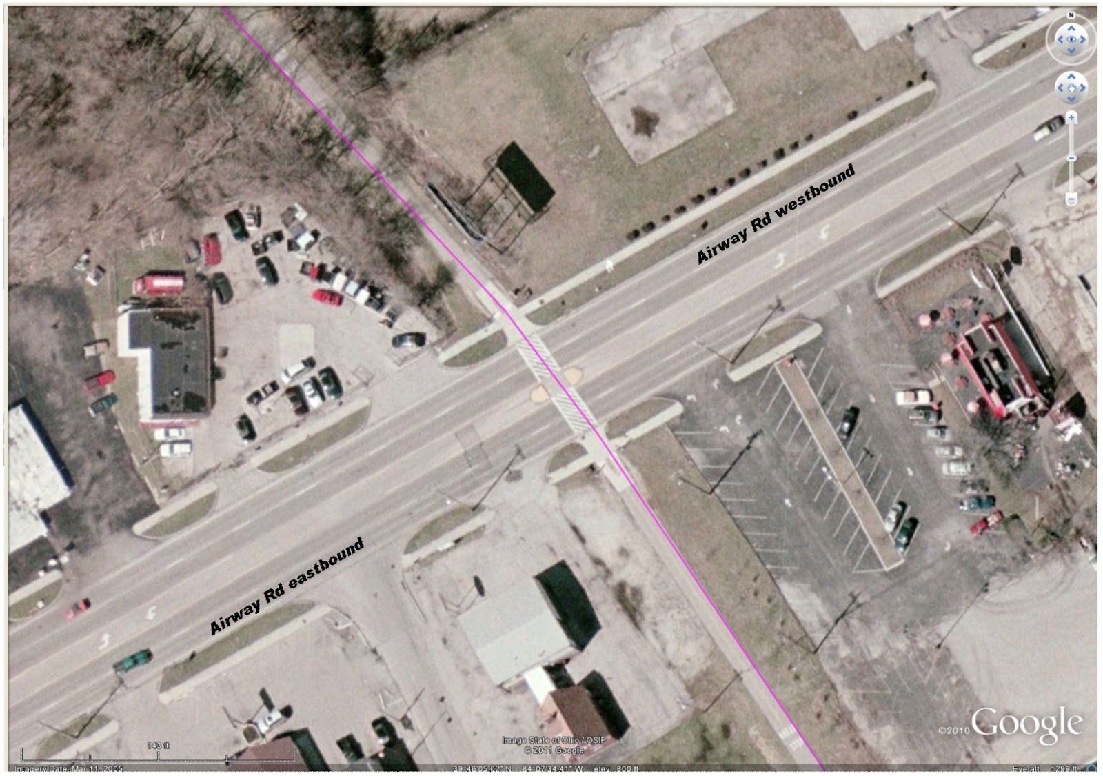
Bikeway crossing (magenta) at Airway Rd, Riverside OH
Then another pair of drivers exhibited their at-any-cost ownership of the road at the bikeway crossing at Airway. This crossing is well marked with pedestrian slashes embossed on the street, auto signs posted for the approaching two lanes of autos from each direction, in-path signage for the approaching bikeway users, and a pedestrian island placed to allow a pause in the crossing. As I approached the crossing from the north (top of image), the street was clear of traffic from the east, and two vehicles approached from as far away as Linh's Restaurant. —At about the location of the green car in the image.— I crossed the two westbound lanes, and saw neither of the two roadway users were slowing. So I stopped at the island. The near driver, of a pickup marked Extermital, sneered and flipped me off. Do I infer again some attitude of impatience—or dominance—from this driver?

No ego from me (for once) feels offence. No shift in mood. And my mood was heightened not more than a couple miles down the bikeway, at the corner of the DPL Executive Golf Course. My happy whistling startled three beautiful, strong deer who looked up from their grazing beside the bikeway. They glanced at each other, then scattered into the trees that line the bikeway. Four more deer inside the DPL compound galloped in the opposite direction toward the tree-lined creek.

At Woodbine, I saw Two-dog-Jason approaching the crossing from the south. Since I had to stop for a car, my crossing was slow. I introduced myself and Two-dog-Jason told me his name: Pat. It's been at least three years that we've seen each other on the bikeway during my morning commute. Finally there are real names for us to add to our hellos.

Central Park, New York City
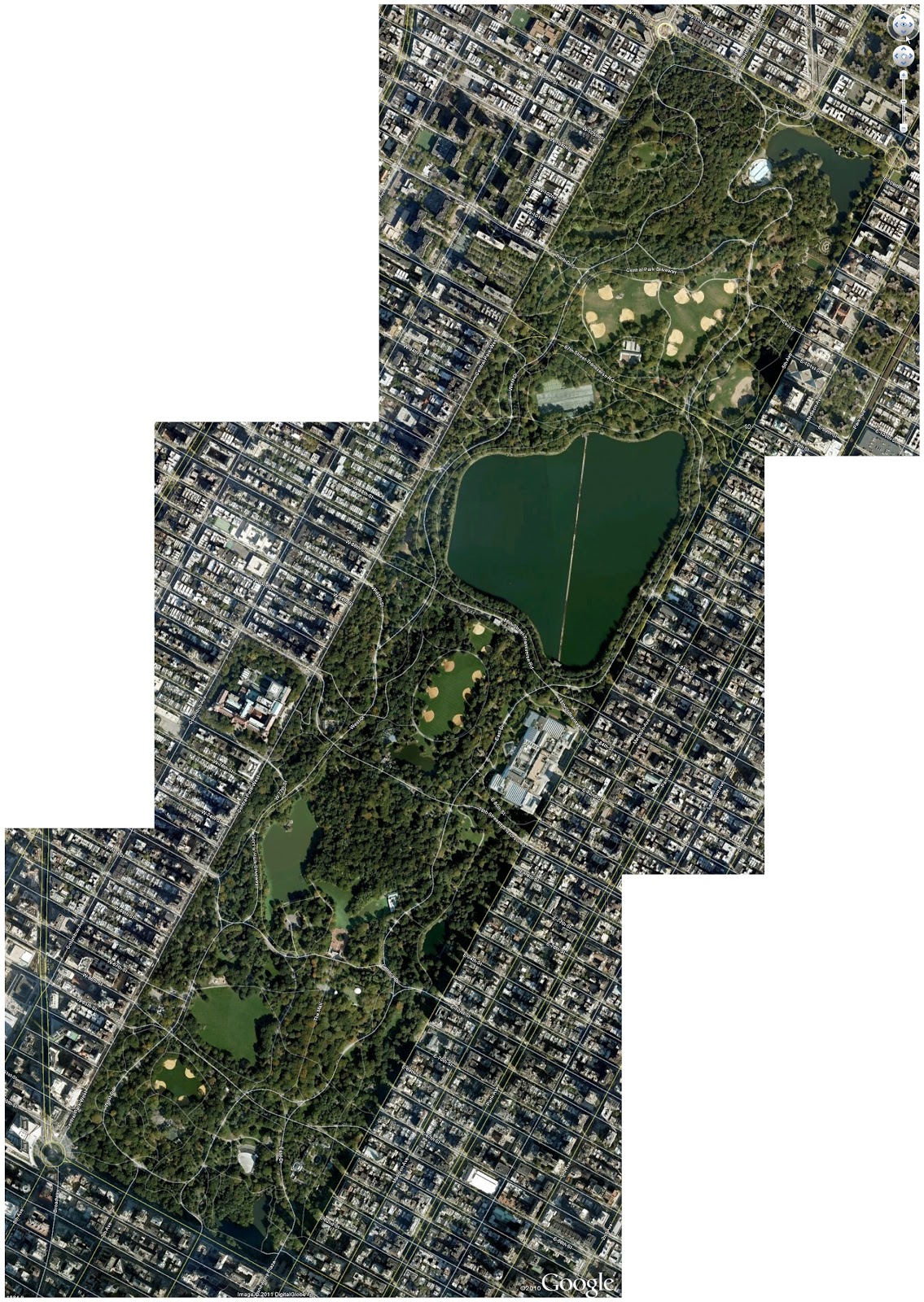
In New York City's Central Park another controversy is developing. In the hardcopy version, the article was titled "Neither Pedestrian Nor Auto." (It is otherwise titled in the online edition.) But the summarized assertion of the original title exhibits a basic misunderstanding of the position of the bicycle in the mix of transportation. Absolutely the bicycle is a vehicle. The cyclist is also a pedestrian—when a cyclist dismounts, the transformation is then complete. But nevertheless, all—motorist, cyclist, and pedestrian—must obey posted traffic signage. At issue for cyclists using Central Park are the questions of courtesy and obeying the hierarchy of trail usage. (In trail usage, cyclists must give right-of-way to pedestrians and horses; pedestrians must give right-of-way to horses; horses must give freedom-from-road-apples to everyone.)

From the few visits I have made to Central Park, it is not the best location for bicycle training. The number of strollers who also use the streets and paths that are closed off from vehicular traffic is too large for developing power, heart strength, stamina. The park is, though, well suited for the casual, pleasant Sunday ride with the family. Begging for attention is whether any convenient location exists on Manhattan Island for cyclists to train, free from the traffic snarls, exhaust, and stop-and-start progress of the streets.

Temperature: 37°F at 07:20, 29 to 39°F at 09:15
Precipitation: none
Winds: none
Clothing: Top with 4 layers (Lycra longsleeve undershirt, skinsuit, arm warmers, poly fleece vest, Lycra-wool jacket); Bottom with 2 layer (skinsuit, quilted tights); ankle socks. Quilted gloves. (Comfortable at first, but zipping down 3 of the top layers by the time I reached Woodbine. Moderate sweating in chest & back.)
Bike: Lotus fixed-gear
Time: 0:55:00 (approx.) for 11.86 miles
Bikeway users: 3 pedestrians, 4 dogs, 7 deer

07:50—departing from home.
08:xx—passing the zig-zag up from the Mad River Bikeway.
08:xx—passing the west gate to Eastwood Park.
08:xx—passing the trestle remains at Linden.
08:45—arriving at work. (No checkpoint times available.)

23 March 2011

Accessibility by bike from the Miami Valley bikeways

At the dinner meeting of Dayton Bicycle Adventures, I asked several people if they planned on commuting to work by bicycle. —Now I didn't ask everyone there, just those few sitting near me.— Most replies were along the lines of "I don't have a way to freshen up after the ride." "The distance is too far." "The bikeways don't connect directly enough." "The streets from home (or to the workplace) are too busy."

The last two reasons are a heart breaker for me, since we often celebrate the 300 miles or more of bikeways in the Miami Valley. But the reasons reveal an essential truth.

How the Bikeway System Fails the Suburbs
Here is the Dayton-Xenia bikeway system plotted over a Google Earth map. The brighter green paths are the Great Miami River Trail (GMR) and the Little Miami River Trail (LMR). The pale green paths are the Creekside Trail that connects the GMR and the LMR trails and the Ohio to Erie Trail that connects toward Columbus and northeastern Ohio. The blue paths are various trails that are presently incomplete, with plans from the MVRBC and Metroparks to complete them.


Click the image to see a larger version. Then click Back on your browser.
 With those incomplete trails, the Dayton area has these conditions.
  •  Much of Kettering, Oakwood, and Centerville are cut off from the bikeways. 
  • Northwest Dayton and Trotwood are effectively cut off from the fully-connected system, with the poor state of the bikeway adjacent to McGee Boulevard.
  • Englewood and Union are similarly cut off, with the lack of a connector from Englewood Reserve to, for example, Sinclair Park.
  • Huber Heights has access to the bikeway, but only at the extreme west edge of the city.
  • Fairborn is also cut off, due to the inability to develop the right-of-way through Riverside and the Dayton well fields that otherwise would connect to the Huffman Reserve and the Huffman Prairie bikeway.
  • Two of the four largest potential sources of enthusiastic, year-round bike commuters—Wright-Patterson Air Force Base and Wright State University—are poorly served by gaps in the bikeway system.
  • And finishing our clockwise survey, the Iron Horse Trail edges toward The Greene, then feints westerly before it disappears in the recreational facility around Delco Park. Thus Bellbrook, once the area renowned for superb cycling roads, is left isolated, even from the Little Miami Trail.
I'm one of the very lucky cyclists, for whom home is less than two miles of quiet residential streets from a bikeway (in my case either the Wolf Creek Trail or the Great Miami River Bikeway) and work is less than a mile from another point on the bikeway (in my case Research Park from the Iron Horse Trail).

But I too look forward to the day when all the trails are contiguous. Some day the system will look like this, with the violet paths connecting the green and blue bikeways that exist now.

Click the image to see a larger version. Then click Back on your browser.


How the Bikeway System Fails the Commuter
or the Errand Runner 
I'm also lucky in how well my bike commute correlates to my auto commute. My 12.5-mile commute, which has 85% of it on the bikeway, is an ideal distance for combining transportation and exercise. With very little exertion, it is a commute of an hour and 10 minutes. With a training intent, it is a commute of 45 minutes. On the other hand, my most direct commute by auto is 9.5 miles and takes about 20 minutes. The same route by bicycle takes about 30 minutes at the highest intensity. (Though that timing is from my experience of more than 15 years ago, when I was much stronger—and less cowed by auto traffic.)

I know of only one cyclist who regularly commutes between Miamisburg and the Research Park area. I see him (Jeff) only during the "rush hours" of long Summer days, since his bike commute requires more than an hour door-to-door.*Corrections at the break.* I estimate that his auto commute is 15 miles, and that his bike commute is 20 miles. He follows the auto route in outline, going north to downtown Dayton, east, and then south to Research Park. But his bike route goes to the Dayton hub on the north side of downtown, while the auto route goes to the freeway junction at the south side of downtown. That lack of correlation would dissuade most cyclists from commuting. Other cyclists consider this 20-mile distance much too far for commuting, and I believe Jeff commutes by bike frequently only during the Summer.

The regional bikeways follow a modified hub-and-spokes design. The design has two hubs: Dayton and Xenia. Each of these hubs have five spokes. The Dayton hub spokes are...
  • GMR trail north to Taylorsville Reserve and on to Troy
  • Mad River and Creekside Trails to Beavercreek and Xenia
  • GMR trail south to Miamisburg and Franklin
  • Wolf Creek trail eventually to Trotwood and Verona
  • Stillwater River trail through DeWeese and Wegerzyn Parks to Sinclair Park and eventually to Englewood
The Xenia spokes are...
  • LMR trail north to Yellow Springs and Springfield
  • Ohio and Erie trail to Charleston and London
  • Ohio Mound trail to Jamestown and eventually to Washington Court House
  • LMR trail south to Waynesville and Loveland
  • Creekside and Mad River trails to Dayton
The hub-spokes system works well enough if you want to ride from the periphery to the center, or from the center to one of the spoke ends. But what if you want to bicycle for an errand to a neighboring town, for example from Miamisburg to Centerville, or from Vandalia to Englewood? Then you have to bike to the hub and out on an adjacent spoke.

I'll offer an idea in another post.